Mauléon-Licharre
Appearance
(Redirected from Mauléon-Soule)
You can help expand this article with text translated from the corresponding article in French. (December 2008) Click [show] for important translation instructions.
|
Mauléon-Licharre
Maule-Lextarre | |
|---|---|
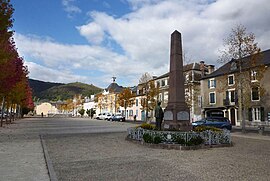
 Main square, Mauléon | |
| Coordinates: 43°13′31″N 0°53′09″W / 43.2253°N 0.8858°W | |
| Country | France |
| Region | Nouvelle-Aquitaine |
| Department | Pyrénées-Atlantiques |
| Arrondissement | Oloron-Sainte-Marie |
| Canton | Montagne Basque |
| Intercommunality | CA Pays Basque |
| Government | |
| • Mayor (2020–2026) | Louis Labadot[1] |
| Area 1 | 13 km2 (5 sq mi) |
| Population (2021)[2] | 2,954 |
| • Density | 230/km2 (590/sq mi) |
| Time zone | UTC+01:00 (CET) |
| • Summer (DST) | UTC+02:00 (CEST) |
| INSEE/Postal code | 64371 /64130 |
| Elevation | 133–521 m (436–1,709 ft) (avg. 214 m or 702 ft) |
| 1 French Land Register data, which excludes lakes, ponds, glaciers > 1 km2 (0.386 sq mi or 247 acres) and river estuaries. | |
Mauléon-Licharre (French pronunciation: [moleɔ̃ liʃaʁ]; Basque: Maule-Lextarre, Occitan: Maulion e Lisharra), or simply Mauléon, is a commune in the Pyrénées-Atlantiques department in southwestern France.[3]
It is the capital of the Soule (Zuberoa) historical Basque province.
It is home to the canvas shoe, the espadrille and etorki cheese.
Demographics
[edit]
|
| |||||||||||||||||||||||||||||||||||||||||||||||||||||||||||||||||||||||||||||||||||||||||||||||||||||||||||||||||||||
| Source: EHESS[4] and INSEE[5] | ||||||||||||||||||||||||||||||||||||||||||||||||||||||||||||||||||||||||||||||||||||||||||||||||||||||||||||||||||||||
See also
[edit]References
[edit]- ^ "Répertoire national des élus: les maires" (in French). data.gouv.fr, Plateforme ouverte des données publiques françaises. 4 May 2022.
- ^ "Populations légales 2021" (in French). The National Institute of Statistics and Economic Studies. 28 December 2023.
- ^ INSEE commune file
- ^ Des villages de Cassini aux communes d'aujourd'hui: Commune data sheet Mauléon-Licharre, EHESS (in French).
- ^ Population en historique depuis 1968, INSEE
External links
[edit]Wikimedia Commons has media related to Mauléon-Licharre.
- MAULE-LEXTARRE in the Bernardo Estornés Lasa - Auñamendi Encyclopedia (Euskomedia Fundazioa) (in Spanish)
- Mauleon and the Medieval History of Navarre


