Crookhaven
Crookhaven
An Cruachán | |
|---|---|
Town | |
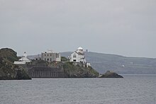
 Waterfront in Crookhaven | |
| Coordinates: 51°27′47″N 9°43′13″W / 51.463°N 9.7202°W | |
| Country | Ireland |
| Province | Munster |
| County | County Cork |
| Area | |
| • Total | 2.57 km2 (0.99 sq mi) |
| Elevation | 11 m (36 ft) |
| Population | |
| • Total | 59 |
| • Density | 23/km2 (59/sq mi) |
| Time zone | UTC+0 (WET) |
| • Summer (DST) | UTC+1 (IST (WEST)) |
| Irish Grid Reference | V805255 |
| Website | www |
| Crookhaven Lighthouse | |
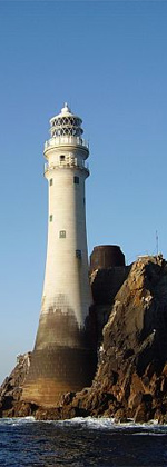
 Crookhaven Lighthouse | |
| Coordinates | 51°28′35″N 9°42′17″W / 51.476470°N 9.704744°W |
| Constructed | 1843 |
| Construction | masonry tower |
| Height | 14 metres (46 ft) |
| Shape | cylindrical tower with balcony and lantern |
| Markings | white tower and lantern |
| Power source | mains electricity |
| Operator | Crookhaven Lighthouse[3][4] |
| Focal height | 20 metres (66 ft) |
| Lens | 3rd order dioptric lens |
| Range | white: 13 nautical miles (24 km; 15 mi) red: 11 nautical miles (20 km; 13 mi) |
| Characteristic | LFl WR 8s. |
| Ireland no. | CIL-2570 |
Crookhaven (Irish: An Cruachán) is a village in County Cork, Ireland, on the most southwestern tip of the island of Ireland. With an out-of-season population of about sixty, it swells in the summer season to about four hundred, when the occupants of the seasonal holiday homes arrive.[1]
History
[edit]The village name is attributed to an association with the Crooke family, and initially with Sir Thomas Crooke, 1st Baronet[5][6] who also founded Baltimore, County Cork about 1610. The Crooke family were granted large estates in west Cork in the early 17th century, but their association with the area ended around 1665, on the death of Sir Thomas's son and heir Sir Samuel.[7] In the late 1500s and early 1600s the village was used as a base for piracy[8] - where not only the local justices (including the vice-admiral of Munster) but the broader population were involved.[9] These activities were unaffected by official discouragement under King James VI and I, but the Dutch attack on Crookhaven in 1614 did significant damage[10] and English piracy in the region declined thereafter.
The village was an important port of call for shipping between Europe and the United States, and many inhabitants were in the business of supplying the ships as they sheltered in Crookhaven after or before a long voyage.[11] In 1959 Crookhaven was the subject of a film by English film maker James Clarke in his film Irish Village.[12] At that time the film records the population of the town and local farms as being 69.
Crookhaven was also used by Guglielmo Marconi as a location for experiments in wireless communication and ship-to-shore communication. Some of these tests and experiments took place between the Fastnet lighthouse, Crookhaven, and Cape Clear Island - since they were so closely connected. The area was useful for these purposes as a fixed telegraph line also connected Crookhaven and Cape Clear Island - located eight miles away. Marconi worked here from 1901 until 1914 when he sold the rights. The station was ultimately destroyed in 1922.[13]
Amenities
[edit]The village has three pubs and also has a shop and post office.
As with certain other amenities, the Crookhaven Harbour Sailing Club also only opens in the summer.[14]
Places of interest
[edit]The road to the village comes from Goleen and curves around the harbour. As one drives from Goleen, one passes a road to the left leading onto Rock Island. Originally this was the site of a coast guard station - which replaced an earlier station to its south. The "new" station was occupied from 1907 until 1921. During the Irish War of Independence, British forces were stationed there to protect the station and nearby signal station at Brow Head. In August 1920, the IRA raided the Brow Head station and it was subsequently destroyed.[15][16][17] Also on Rock Island was a fishery plant. From here most of the shellfish of Ireland was exported to Europe. The ponds were open until the late 1970s, then it became a food processing plant packaging garlic butter and mussels - but since fell derelict.[citation needed]
Transport & communications
[edit]The village is located in south-western Ireland, 132 kilometres (82 mi) from Cork and 383 kilometres (238 mi) from Dublin. The nearest airport to Crookhaven is Cork Airport, and the regional road R591 ends in the village. Crookhaven has no scheduled public transport.
Notable people
[edit]Jeremiah Coghlan, naval captain in the French Revolutionary and Napoleonic Wars, "an officer almost unrivaled in heroic exploits".[18]
See also
[edit]References
[edit]- ^ a b On 10 April 2011 ("census night"), the population was recorded at 59 persons in 23 occupied houses, from a housing stock of 125 houses (a 79.2% vacancy rate) "CSO table CD153". Archived from the original on 28 October 2017.
- ^ "CD153: Cork Population by Private Households, Occupied and Vacancy Rate by Townlands, CensusYear and Statistic (2011)". Census 2011. Central Statistics Office. 2011. Archived from the original on 28 October 2017. Retrieved 28 October 2017.
- ^ Rowlett, Russ. "Lighthouses of Southwestern Ireland (Munster)". The Lighthouse Directory. University of North Carolina at Chapel Hill. Retrieved 7 May 2016.
- ^ "Crookhaven Lighthouse". Commissioners of Irish Lights. Archived from the original on 15 May 2016. Retrieved 7 May 2016.
- ^ "History". Crookhaven.ie. Archived from the original on 5 November 2016. Retrieved 9 January 2017.
- ^ "An Cruachán / Crookhaven". Placenames Database of Ireland. Logainm.ie. Archived from the original on 9 January 2017. Retrieved 9 January 2017.
Earliest reference to Crookehaven attributed to "Calendar to Fiants of reign of Henry VIII. 1510-47...of Queen Elizabeth. 1558-1603 (print 1875-90)
- ^ Burke, John (1841). Extinct and Dormant Baronetcies of England, Scotland and Ireland (2nd ed.). London.
- ^ "South-West was haven for piracy and prostitution". Irish Examiner. 12 April 2012. Archived from the original on 9 January 2017. Retrieved 8 June 2015.
- ^ Senior C.N. (2004). A Nation of Pirates: English Piracy in its Heyday. Penguin Books. p. 349. ISBN 978-0-14-029724-9.
As quoted in Rodger, N.A.M., The Safeguard of the Sea. A naval history of Britain, 660-1649.
- ^ "Adventures of 17th-Century Pirate Alliance Uncovered". Discovery Communications (News). Archived from the original on 9 May 2015. Retrieved 8 June 2015.
- ^ "Mizen Head Signal Station". MixenHead.net. Archived from the original on 17 July 2007.
- ^ "Irish Village Film details". Irish Film & TV Research. Trinity College Dublin. Archived from the original on 9 January 2017. Retrieved 9 January 2017.
- ^ Sexton, Michael (2005). Marconi The Irish Connection. Portland: Four Courts Press. ISBN 9781851828401.
- ^ "Crookhaven Harbour Sailing Club". Croomhavenhsc.com. Archived from the original on 1 January 2017. Retrieved 9 January 2017.
- ^ "Cork". Cork Examiner. 24 August 1920.
In the early hours of Saturday morning the Signal Station at the Brow Head was raided by masked and armed men
- ^ "Irish Disorder". The Observer. 28 August 1920 – via trove.nla.gov.au.
An armed force of Sinn Feiners surprised a coastguard at Brow Head, County Cork, and removed a large quantity of stores
- ^ Lloyd's Calendar. Lloyd's of London Press. 1924. p. 64.
Brow Head Signal Station destroyed by fire and bombs (Aug. 31)
- ^ Ward's miscellany (and family magazine). 1837. p. 304. Archived from the original on 25 September 2021. Retrieved 9 December 2020.


